Top

clams

Uncharted territories: outer islands of the Socotra archipelago

On my last visit to Socotra two years ago, our guide casually mentioned one evening by our campfire that he wanted to organise a scuba diving trip to the outer islands of the archipelago: Abd al Kuri, Samhah and Darsah. The islands are largely uninhabited, save for a few dozen fishermen and their families. More excitingly, no recreational divers had ever been diving off these islands: they were essentially virgin diving territory, something that is next to impossible to find on our planet these days. Needless to say, I was in.

The prospect of being the first people to explore a small corner of the Earth had me excited for months prior to the expedition this spring. The diving off Socotra had been spectacular, with underwater fields of hard coral gardens exploding with color, shipwrecks slowly being taken over by the sea, and large schools of tropical fish unaccustomed to and unafraid of visitors to their depths. What would we find even further afield?

Socotra Qalansiyah port fishing boats

Fishing boats in the port of Qalansiyah, Socotra

The logistics of getting several divers, gear, tanks, a compressor to refill the tanks, a supply of food, and a vessel to transport it all to the outer islands turned out to be formidable. This is, after all, Yemen. Fortunately, our organiser, Piotr Pazola, speaks Arabic, has been to Socotra seven times, and knows what it takes to get things done. There is just one divemaster living on Socotra with a couple dozen tanks and a compressor, so we brought the rest of our gear. In recent years, the United Arab Emirates have been funding numerous development projects throughout Socotra, including a new military airport base on Abd al Kuri. As a result, after much back and forth over dinner and tea and more dinner and more tea, we received permission to travel to Samhah and Darsah aboard the dhow we had previously secured for the week.   

Yemen Socotra dhow ship

Our dhow near the port of Qalansiyah

We met the dhow at noon the following day in the port of Qalansiyah on the western end of Socotra, a few hours’ drive from the main settlement of Hadiboh. The captain, a half dozen or so male crew members, and three armed Yemeni soldiers helped load all of our supplies onto the dhow, and we set sail for Samhah. The dhow had an underbelly where everything was stored; a main level where we ate, lounged, and napped; and a small upper area that received much of the engine fumes and was as a result uninhabitable while the dhow was in motion. The “bathroom” was an open air semicircle, roughly waist height, attached to the outside of the main level with a hole in the middle. As there was no privacy on the dhow, we opted to camp on the islands at night.

Yemen Socotra dhow sunset

Sunset from the dhow, Samhah

Yemen dhow bathroom

The bathroom on the dhow

After about six hours, we reached Samhah just as dusk enveloped the island in darkness. We stopped at the main fishing village on the island to declare our arrival to the local sheikh, an ancient-looking man who extended to us every kindness during our stay (though he did try to barter for one of the other female travellers to remain on Samhah as his companion). We set up camp on a beautiful stretch of beach backed by semi-desert and immediately jumped in for a night swim to cool off. To our delight, the sea around us came alive in numerous shades of bright blue in a grand display of bioluminescence. We fell asleep lulled by the sound of the waves crashing just beyond our sleeping bags. 

Socotra Samhah island beach

The beach where we camped on the island of Samhah

Yemen Socotra Samhah children playing

Local children, Samhah

For the next few days, we explored Samhah and Darsah, diving three to four times a day from morning to night and enjoying meals of freshly caught fish on the beach in between. The diving did not disappoint: we saw turtles, rays, moray eels, barracuda, curious white-tipped reef sharks, nudibranchs galore, stonefish, scorpionfish, bubble algae, and more. On one dive, a pair of sand sharks chased each other round in circles; on another, an enormous school of glass fish ebbed and flowed around giant coral heads. In these moments, there is nothing else but the now as you breathe, take in your surroundings, and recognise how lucky you are to exist in this beautiful world.

Yemen Darsah beach cove

Coves on Darsah

Yemen Socotra scuba diving boat

Returning from a dive all smiles

We named one particularly beautiful site Polish Garden, as the first recreational divers to ever dive the site. We also dove the wreck of a giant bulk carrier that had run aground 10 years prior and was now distributed just below the surface at about 10m, encrusted with coral and giant clams as the sea slowly took it over. Schools of grunt hovered around the former bridge of the ship, and we moved to and fro with the waves as we approached the shallows of the wreck. In between dives, we enjoyed being the only humans for miles as we walked along deserted, postcard-perfect beaches, explored sea caves, and watched the sun set over the mountainous interiors of the islands. Our days finished with simply grilled fish as we watched a multitude of stars migrate overhead before falling asleep on the sand. 

Yemen dhow fishing

Lunch

Scuba diving shipwreck Yemen Samhah

Scuba diving a shipwreck off Samhah island

On our final day, as we motored away from Darsah, the clouds above the island briefly assumed the shape of a vintage tea kettle, with a genie billowing out from it in white wisps. Make a wish, the genie beckoned. Anything you want. 

I made my wish. A few minutes later, the cloud was back to a simple tea kettle, giving off a few puffs of steam.

Socotra Darsah beach deserted

A deserted beach on Darsah island

Socotra, Yemen: untouched frontiers

I remember reading about the remote island of Socotra, Yemen, as a young girl. Known as the Galapagos of the Middle East, with nearly 40% of its plants and trees found nowhere else on the planet, Socotra seemed almost unreal. Isolated from the mainland over 6 million years ago, its endemic species resemble something out of a science fiction novel - dragon blood trees (so named for their red sap), bottle trees, and the elusive Socotran chameleon. This year, I decided to make my lifelong dream of visiting the island a reality.

Bottle tree, Socotra, Yemen

Bottle nose tree, Socotra

Visiting Socotra takes some planning: there is just one flight a week, run as a charter flight via Air Arabia out of Abu Dhabi. You cannot book the flight online; you’ll need to work with a tour operator to arrange it as well as your visa. I went with Piotr (Peter), founder of Pazola Travel, who has arranged multiple trips to the island over the years and seamlessly arranged this one. He is also one of the few operators to prominently feature scuba diving on multiple days of the trip; he is a long time instructor with over 8,000 dives under his belt. Our group of 8 met at the Abu Dhabi airport, having packed all of our scuba diving gear, sleeping bags and headlamps, and lightweight clothes for hiking and adventures in the heat. This is a trip for the adventure-minded: we typically spent the night camping or in relatively basic accommodations, and there are no frills (and very few items available for purchase) once you arrive on Socotra for the week.

Sunset over camping tents, Dihamri, Socotra, Yemen

Sunset at camp in Dihamri, Socotra

Upon arrival in Hadibo, the largest town on Socotra with a population of roughly 10,000, we were greeted by our guide, Abdularuf, and three drivers with their respective Toyota Land Cruisers, who would be with us for the week. We spent the first night at the Summerland motel, a popular and clean choice in town that even offers some basic breakfast and limited wifi. We headed out for lunch at the most popular restaurant in town, which served grilled fish, chicken, piping hot freshly made local flatbread, and an assortment of freshly squeezed juices (highly recommended). 

Cooking traditional flatbread, Hadibo, Socotra, Yemen

Cooking local flatbread in Hadibo

Night street scene in Hadibo, Socotra

Hadibo at night

Hadibo itself is relatively vibrant, with plenty of locals walking around (women dressed in black in full burqas and men in traditional local colorful dress), mingling with goats and scores of trash (there is no place to discard of trash on the island, and unfortunately most of it ends up on the streets). This is also a place of extreme poverty: most things that end up on the island must be imported, and this is not cheap (or affordable for most of the population living off the land). At the aforementioned restaurant, any food not consumed by paying customers was promptly carried off to an ever-present group of hungry people who didn’t have the means to pay for a meal. At many of the small villages we passed during our time on the island, we encountered groups of children and families subsisting on the bare minimum to survive. Socotra is truly a sobering place that reminds us of just how small and insignificant we all are.

We are the lucky ones, the ones able to sit back in the Land Cruisers and explore the length of this unique and stunningly beautiful place. Our first stop was the Dihamri marine reserve, the longest coral reef on Socotra, where we set up camp for the night and completed a checkout dive with the only local scuba instructor, Walid. The reef is in near pristine condition, a testament to what our planet might be like with sustainable fishing operations. We observed reef sharks, turtles, and thick forests of richly coloured hard and soft coral gardens. I saw no discernible coral bleaching, which I’ve sadly grown used to as the norm at most dive spots around the world. This is a real underwater paradise–and what’s more, equally amazing for divers as well as snorkelers, as many sites have a maximum depth of 30 ft (10m). After our second dive, we hiked among the nearby bottle trees and gazed into the depths of the Arabian Sea as the setting sun turned everything around us a rainbow of red. 

Socotra mountain lake with dragon blood tree

Homhil, Socotra

Arher beach, Socotra, Yemen

Arher beach, Socotra

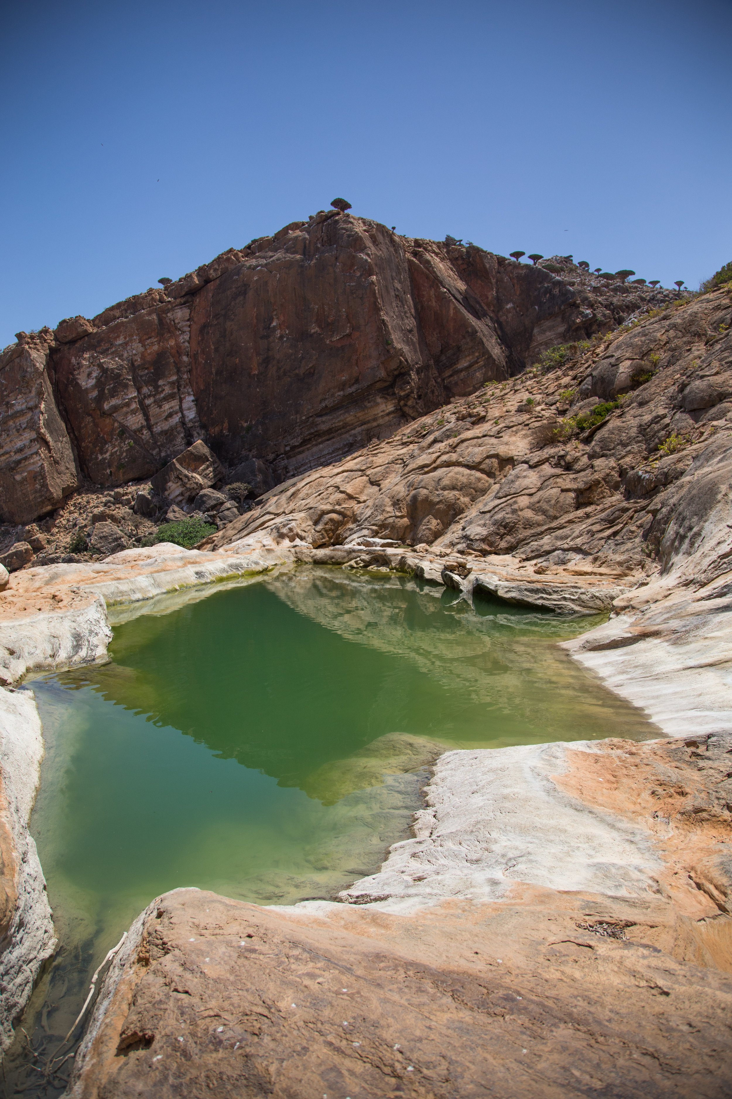
The next morning, we set off further east towards the landscape-dominating sand dunes of Arher. We detoured towards Homhil in the mountains in the interior, from where we hiked with a local guide through dragon’s blood trees and curved canyons shaped by centuries of water culminating in nearby pools overlooking the plateau below us blending into the sea. We trekked down the mountain towards the beach at Arher, where we enjoyed a late afternoon swim with dolphins and a myriad of fish in crystal clear waters. After a quick rinse in the nearby river, we set up camp for the night directly on the beach, falling asleep to the crashing waves. Waking up about an hour before dawn, we hiked up the cool dunes in darkness to enjoy from the top one of the most beautiful sunrises I’ve seen in my travels. 

Sunrise from Arher sand dunes, Socotra, Yemen

Sunrise from Arher sand dunes, Socotra

Sunrise over Arher sand dunes, Socotra

After descending for a light breakfast by our camp, we headed to the easternmost part of Socotra, the fishing village of Irsal, from where we dove a shipwreck covered in decades of reef growth: giant clams, mussels, and bits of hard coral. Afterwards, backtracking eastwards, we completed a second dive (my favourite of the trip) at Rosh. Diving below the surface, we encountered one of the most beautiful and pristine hard coral gardens I’ve ever seen, full of life: a pair of lobsters chasing each other around coral heads, abundant schools of butterflyfish, and a rich microcosm of tiny nudibranch, shrimp, and crabs. 

Irsal fishing village boats, Socotra, Yemen

Colourful fishing boats in the village of Irsal, Socotra

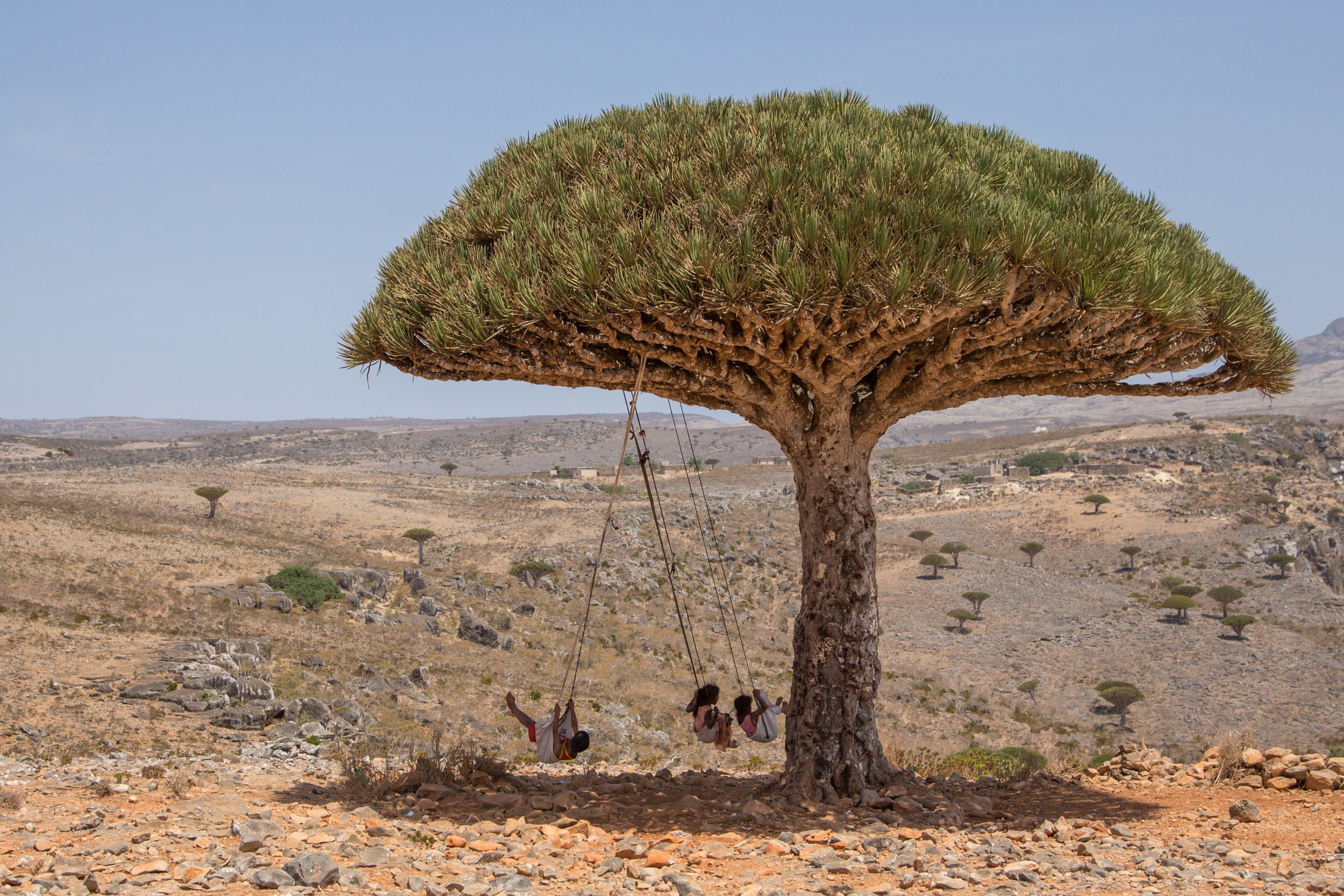
Children swinging from dragon's blood tree, Socotra, Yemen

Children swinging from a dragon blood tree, Socotra

Path through dragon's blood trees, Socotra, Yemen

A path through the dragon blood trees in Dicksam, Socotra

Dragon's blood trees in late afternoon light, Socotra, Yemen

Dragon blood trees in Dicksam, Socotra

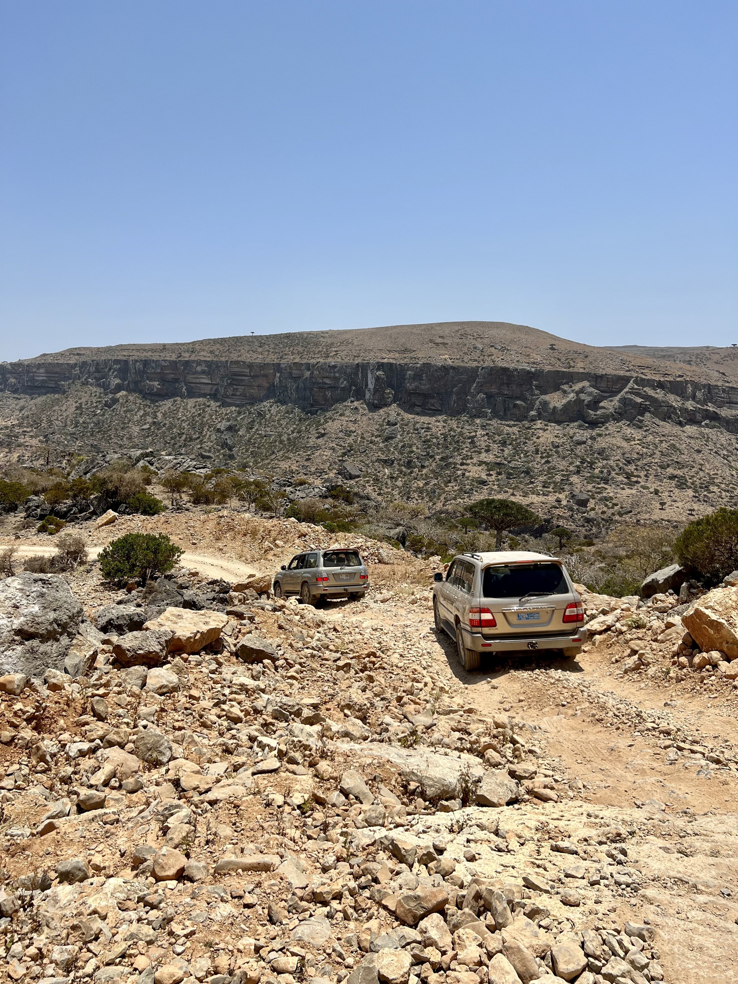
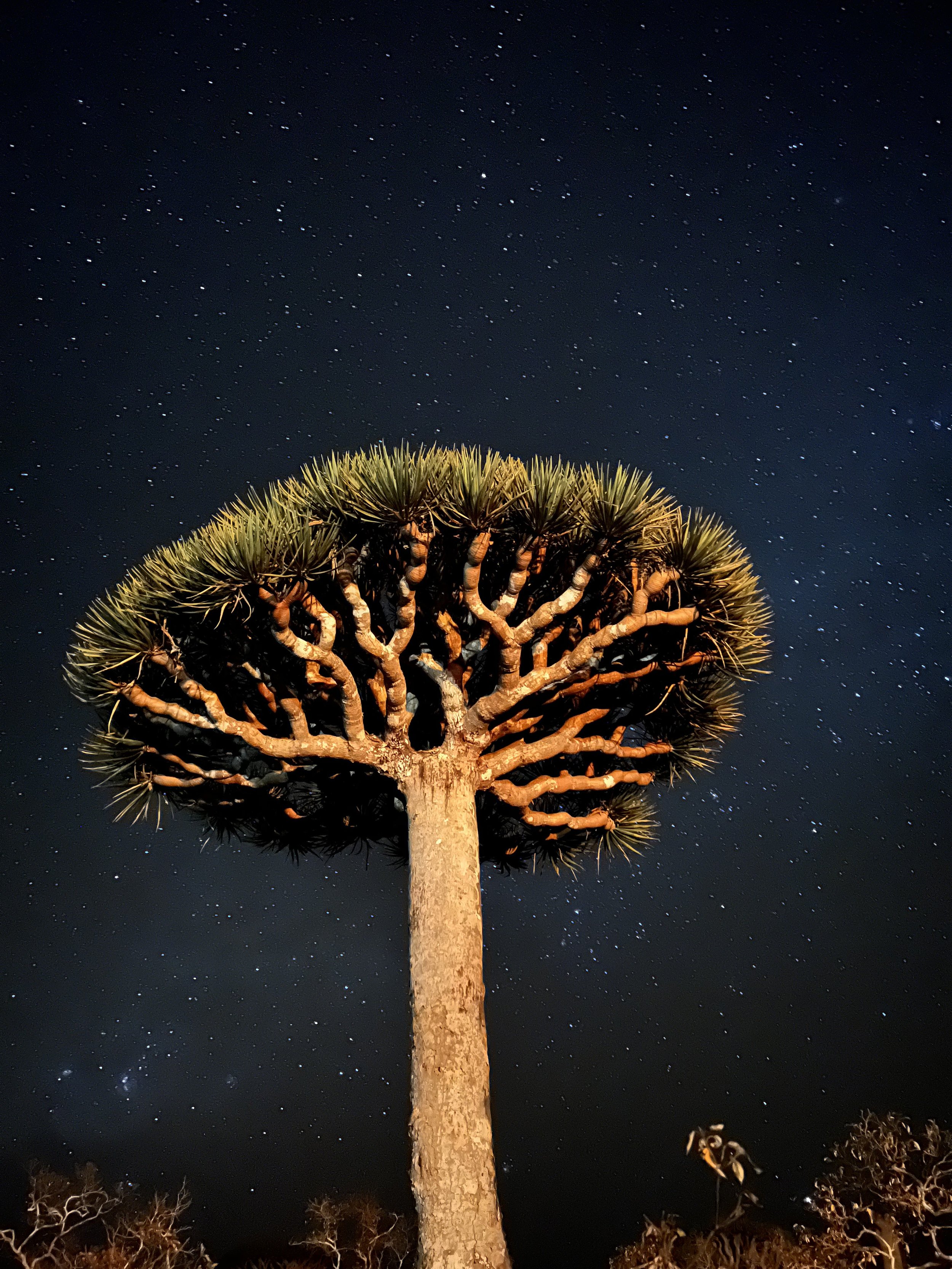
We next ventured into the interior of Socotra, into the depths of Dicksam, reachable via an extremely rocky and long road full of switchbacks. We were rewarded by a sea of dragon’s blood trees stretching in every direction and some of the clearest night skies still largely untouched by human life (and light). We walked through the trees as afternoon turned to dusk turned to night, a showcase of stars complementing the ancient trees around us. The best places I’ve travelled to are the ones that remind you of your fleeting existence on this planet and the immensity and greatness of the world around us; they fill you with hope that despite our destructive tendencies, humans will find a way to live sustainably and coexist with the products of millions of years of evolution. Socotra is one of these places.

Rocky road and Land Cruisers, Dicksam, Socotra, Yemen

The road to Dicksam

Dragon's blood trees at sunset, Socotra, Yemen

Watching the sunset over dragon blood trees, Socotra

Sky full of stars over dragon blood tree, Socotra, Yemen

The endless night sky in Dicksam, Socotra

Our last two days on Socotra were spent in the far western stretches of the island, miles from other human beings on the beach of Shouab. The decades-old wreck of a large Qatari ship stretches just offshore, offering plentiful sightings of goliath groupers, schools of tang, and numerous sting rays. We spent two dives here; we could have done ten and that wouldn’t have been sufficient. The privilege of being able to dive in such a remote place was not lost on us, and we emerged from the sea feeling changed. 

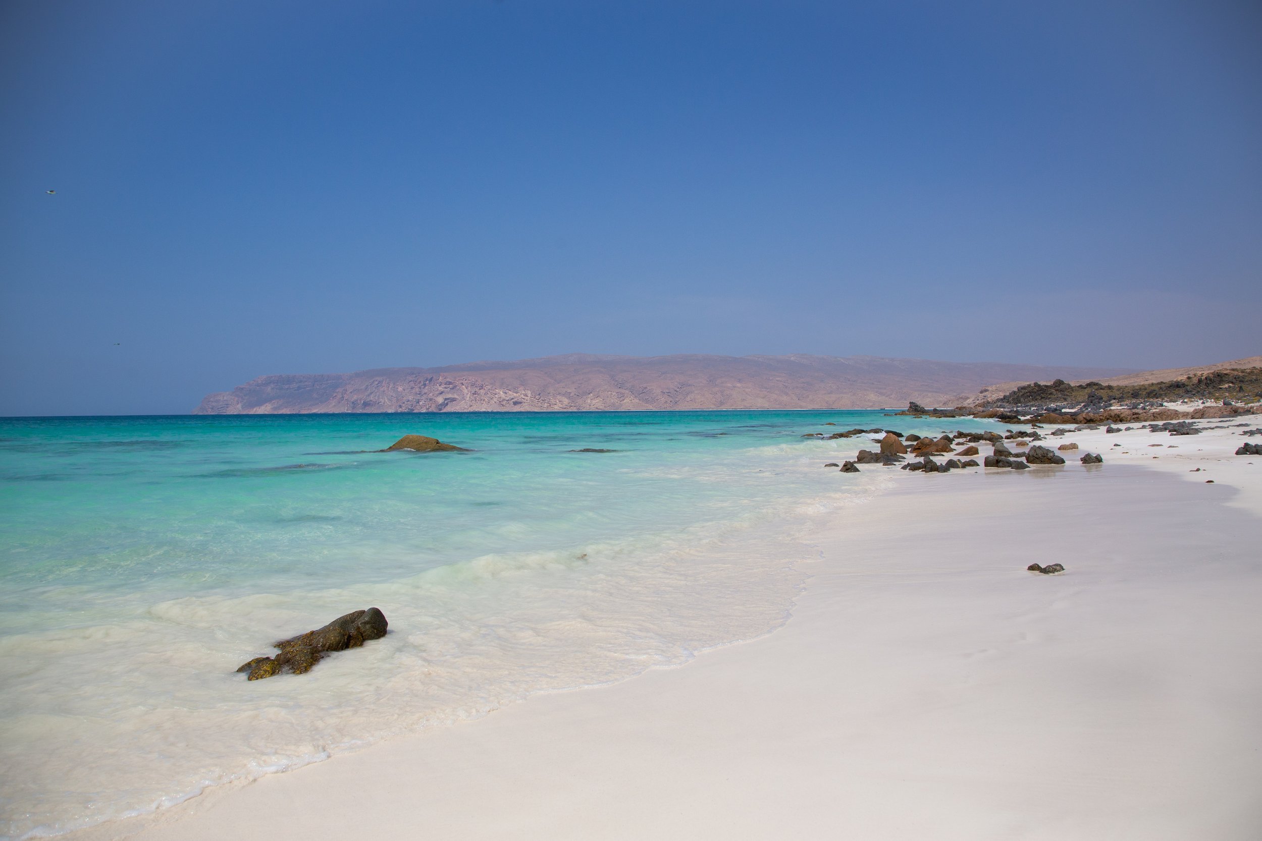
Shouab beach and turquoise sea, Socotra, Yemen

Pristine Shouab beach, Socotra

If you have even the inkling of a feeling to make your way to Socotra, go: this is a place lost in time, unlike any other on Earth. It doesn’t take long to fall into its rhythm, letting go of the business of the outside world, in favour of a more peaceful, simple existence. This is true paradise for those lucky enough to visit. 

What to pack

Pack lightly, but bring essentials such as medications, a fully charged power bank (minimum 30000 mAh depending on the devices you are bringing), extra memory cards for your camera, etc. You’ll want to travel solely with soft-sided luggage (ideally duffel bags that can be both carried and wheeled). Leave your drone at home; there’s a high chance it will be confiscated by airport authorities in the UAE, where they are illegal.

Most operators will travel with local crew, including a guide, drivers, and chef. The food on our trip exceeded all expectations: a rotating cast of local chicken, freshly caught fish, and the ubiquitous goat, all prepared by our cook in the open air by our camp.

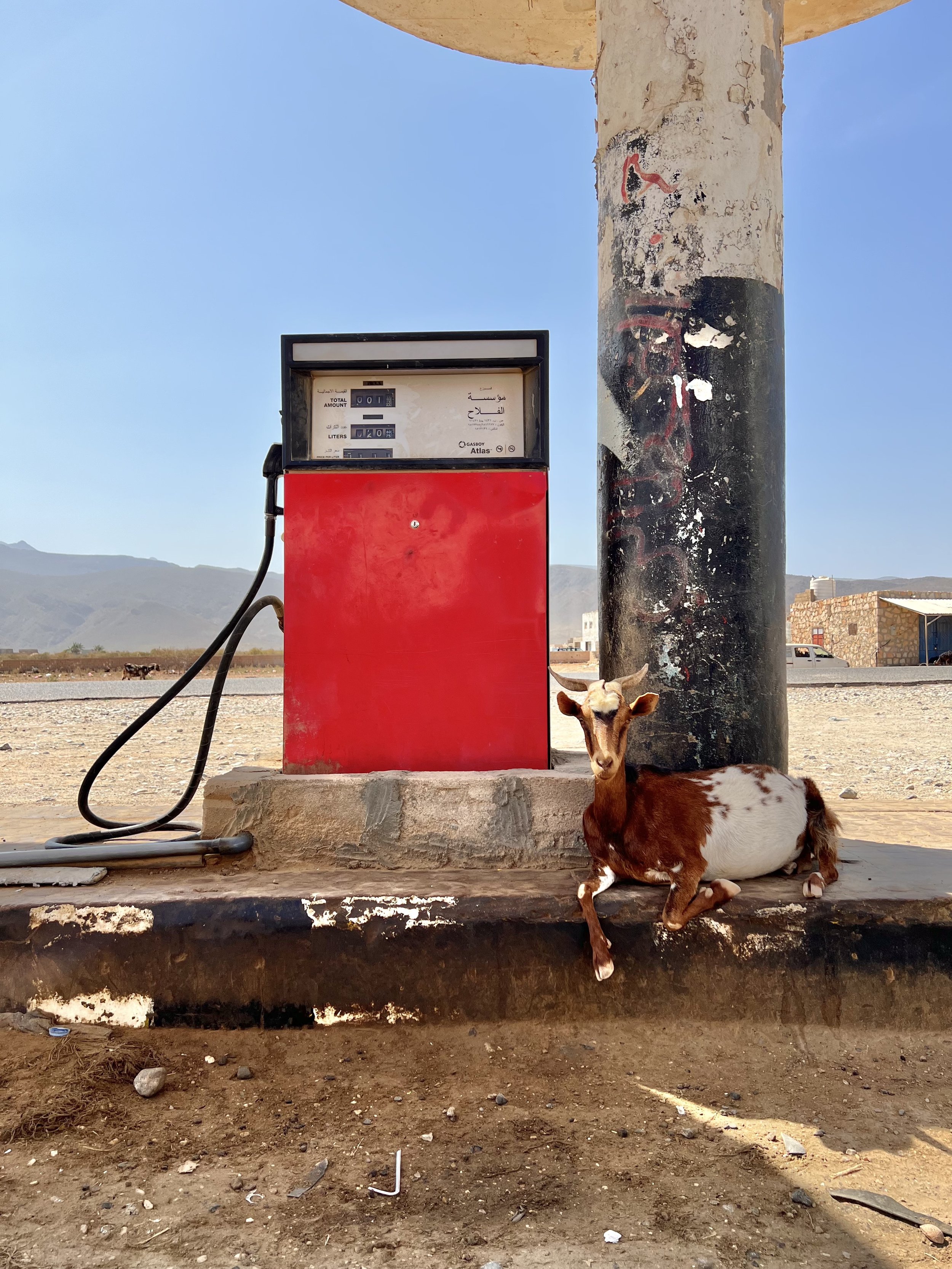
Goat at gas station, Socotra, Yemen

A friendly local on Socotra

If you intend on going with an operator who offers scuba diving, you’ll want to bring all of your own gear, as essentially none is available for rent on the island given there is a sole divemaster. Tanks and weights are of course available, but I recommend bringing an extra mask and ensuring your dive computer has a good working battery. Walid (the local scuba instructor) has a few other pieces of gear for rent, but given the remoteness of the island, the selection is limited and prices are steep. 

Fun fact: There are three things you will see endless amounts of on Socotra: goats, pufferfish, and vultures.

Qalansiyah lagoon, Socotra, Yemen

Detwah lagoon, Socotra

New Zealand: the North of the North

If you’ve read my previous post about New Zealand, you’ll know I fell for the country pretty hard when I visited the North and South islands in a whirlwind two weeks. I went back last month for more, this time spending two weeks in the northern parts of the North Island, which seemed fitting for summertime. It is truly one of my favourite countries in the world: nowhere else is there such a perfect combination of diversity of landscape, little crowding, and amazing local food.

I’ve broken the below into three regional sections; feel free to skip ahead to Auckland & Waiheke, Northland or Waikato & Bay of Plenty.

Sunrise at Cathedral Cove

Sunrise at Cathedral Cove

Auckland & Waiheke

After landing in Auckland, I checked into my cozy Airbnb near the waterfront and strolled over to Shucker Brothers for a feast of local oysters and fish & chips. The following morning, after some light bites at the Auckland Fish Market, I took Fullers ferry over to Waiheke island, known for its vineyards and fresh seafood, for a day trip. Just 30 min each way, the ferry makes the island incredibly accessible, and it’s advisable to rent a car to visit the different vineyards. I stopped for a quick breakfast at Solar Eating House with nice views overlooking Oneroa Bay before continuing eastward towards Man O’ War vineyards, as the paved road turned to gravel and the scenery becoming increasingly wider expanses of green dotted with sheep. There’s a calm bay with a thin stretch of pebbly beach here, which in the summertime fills with boats, swimmers, and kayakers. The wines at Man O’ War are some of the best on the island, with crisp, minerally whites and peppery Syrahs. 

The beach by Man O’War vineyards, Waiheke Island

The beach by Man O’War vineyards, Waiheke Island

Vineyards on Waiheke Island

Vineyards on Waiheke Island

More food may be in order prior to trying more wines, and fortunately Poderi Crisci, run by a Neapolitan named Antonio, is not far away. A picturesque garden setting filled with the smell of jasmine and lavender welcomes you to your table, and traditional Italian staples are on offer. Alternatively, head back towards Onetangi Bay for a delicious seafood spread at Three Seven Two, which has a fantastic indoor/outdoor layout and overlooks the wide stretch of beach. The oysters were some of the best I had in New Zealand, and the wine list is superb. 

Bird’s eye view of Waiheke Island

Bird’s eye view of Waiheke Island

For something a bit different, check out Casita Miro, which feels like stepping into Parc Guell in Barcelona. The wines are decent, but the views make it worth a stop. For better wines, head to Tantalus and the neighbouring Stonyridge, which I followed with a quick stop at the Te Matuku Bay seafood market for another dozen local oysters. Cap off the day at Cable Bay Vineyards, with views of Auckland in the distance. For dinner, back in Auckland, I thoroughly enjoyed the lamb chop at Giraffe together with a friend who flew in to join me for the remainder of the trip.

Northland

Feeling full of oysters and lamb and wine, a rare and happy feeling, the following day we made our way north towards Matapouri, the jumping off point for the Poor Knights Islands, one of New Zealand’s best dive sites. En route, we stopped at the Kaiwaka Cheese shop to sample some local cheeses and other products: the manuka smoked cheddar and jalapeno gouda were particularly tasty. Further north, a quick hike led to the scenic Whangarei Falls, and nearby was the highlight of the day: Abbey Caves. A set of 3 caves reachable from the road via a short walk, these are particularly special because they aren’t commercialised and are filled with glowworms! To the uninitiated, glowworms are not actually worms, but rather larvae of fungus gnats (a much less glamourous term) that produce a bioluminescent blue-green glow. Some of the entrances to the caves are a bit tight, and the caves can be quite wet, so wear appropriate clothing and footwear (ideally water shoes or hiking shoes that can get wet, as well as a headlamp). Turn off your lights once well inside and enjoy the spectacle!

Our Airbnb near Matapouri was clean and well-located to the dive shop the next morning. We went with Yukon dives, and the boat was one of the nicest dive boats I have ever been on, complete with an upper outside area and a lower, fully-enclosed space full of comfortable bean bags and pillows. Beware, however, the water temperatures, which were at just 17C. These are drysuit diving waters, though the dive shop will assure you that everyone is fine in the 6.5mm wetsuits and hoods they supply. I insisted on layering an additional 3mm wetsuit on top of that, and I was still absolutely freezing within about 60 seconds of entering the water. The water was relatively choppy, though underneath the surface, the sway of the large-leafed, bright yellow and green algae was mesmerising. Large schools of fish and stingrays abounded, and multiple swimthroughs surrounded by the yellow algae truly made this a memorable divesite. In the shallows, caverns along the islands make for spectacular backlit window vistas onto the depths. 

Resident emus at Raewyn & Rosco’s farmstay

Resident emus at Raewyn & Rosco’s farmstay

Homemade Christmas dessert at Raewyn & Rosco’s farmstay

Homemade Christmas dessert at Raewyn & Rosco’s farmstay

One of the most memorable Airbnbs of the trip was Raewyn & Rosco’s farmstay in Waiharara, where I was lucky enough to be over Christmas. Their dog Jess came out to greet me, nearly jumping into my car. They joked that since they didn’t have much family in the area, they had rented Americans to entertain them over the holidays. But they have many animals to make up for it: emus, cows, pigs, and ducks roam about, and the property borders a scenic creek upon which you can canoe. They cooked a fantastic Christmas dinner that we were invited to share in, and their breakfasts were the best of the trip. Raewyn & Rosco’s hospitality made me feel right at home despite being thousands of miles away from my own family. 

The next day, we took an incredibly scenic road trip up to Cape Reinga, the northernmost point of New Zealand. It is where the Tasman and Pacific seas meet in a thunderous mix of greens, blues, and greys, and it’s a place of special significance to the Maori, New Zealand’s indigenous people: it is the point where the spirits of the dead enter the underworld. A stunning hiking path leads from near the lighthouse at the end of the peninsula to the completely wild Te Werahi beach. Dress in layers and wear sunscreen; conditions can change quickly. 

Cape Reinga with a view to Te Werahi beach

Cape Reinga with a view to Te Werahi beach

Tasman Sea, Cape Reinga

Tasman Sea, Cape Reinga

Cape Reinga

Cape Reinga

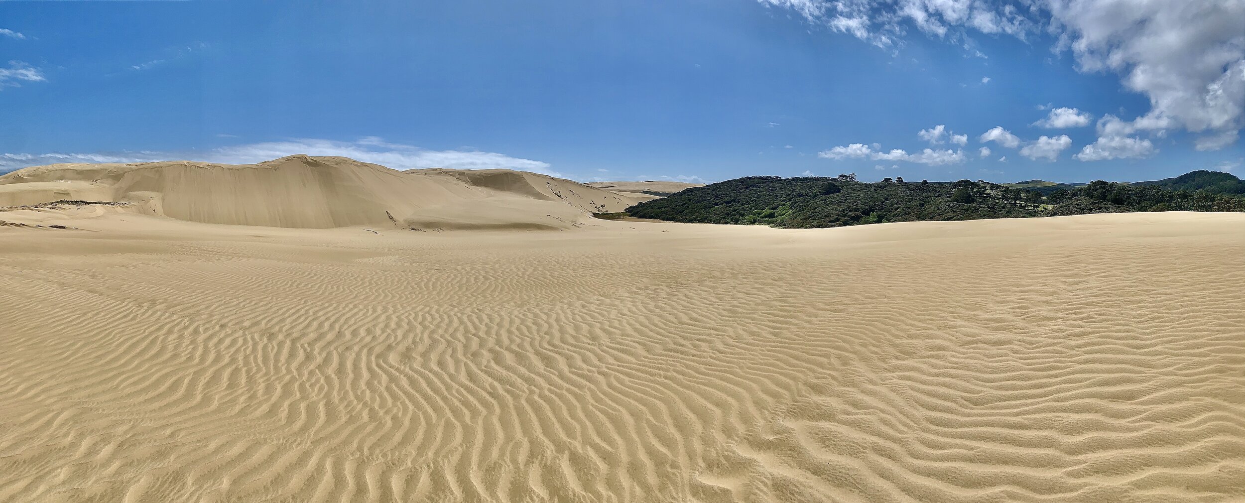
A short drive away are the equally stunning Te Paki giant sand dunes. You’d not be remiss to think you could be somewhere in the middle east, and yet all of these incredibly varied landscapes are in just one part of one small country. Bring a board to coast down the dunes, or simply enjoy getting lost in the alien landscape. 

Te Paki sand dunes

Te Paki sand dunes

Fun in the dunes

Fun in the dunes

Should you be craving a swim after the dryness of the dunes, head to nearby white sand Rarawa beach. If you’ve got a 4x4, you can actually drive onto the beach if you’d like. Kitesurfing is possible here as well if the conditions are right. We also checked out the much windier 90 mile beach (it truly does stretch as far as the eye can see in either direction) on the windward side of the peninsula, where tides can change quickly and more than a few cars have gotten stuck. 

Rarawa beach

Rarawa beach

Kauri tree, Puketi Forest

Kauri tree, Puketi Forest

Our next stop was another farmstay Airbnb further south in Ruawai. En route, we stopped at the Mangonui fish shop for some fish & chips, followed by the Puketi Forest for a short loop hike through a large grove of the currently endangered kauri trees, a species endemic to New Zealand. These large behemoths are reminiscent of California redwoods, but are currently being killed off by an incurable pathogen that can be spread in a single pinhead of soil (typically due to human activity). Signs and spray canisters at the start of trails instruct you to wash and disinfect the soles of your shoes to help prevent spreading the disease. 

The road from Puketi to Ruawai was one of the curviest and emptiest of the trip, and a true pleasure to drive along. Upon reaching Pete & Sara’s farmstay, we were met by Pete, who promptly took us on a short hike to Tokatoka peak to enjoy the vista over the surrounding plains together with his dalmatian, Bella. A former dairy farmer, Pete’s boundless energy and enthusiasm for hosting visitors from around the world was infectious. He introduced us to the alpacas, sheep and donkeys on his farm and showed us how to feed them, and after a home-cooked dinner, we wheeled out his large telescopic to look at the clear night sky largely free of noise pollution. I woke up at 6am to join him at a neighbouring dairy farm where I learned about the process and even milked a couple of cows. Northland is truly New Zealand at its best. 

Waikato & Bay of Plenty

From the rolling hills of Northland, we headed east to the Coromandel peninsula, known among Kiwis for its spectacular beaches and stunning cliffside walks. The drive there along the Firth of Thames is a stunning one and worth the slight detour from the main highway road. Stripes of aqua, turquoise and deep blue merge into each other, and a stroll through Waitawa Regional Park can be a great place to stretch your legs. 

New Chums beach, reachable via a short hike

New Chums beach, reachable via a short hike

Coromandel itself is a cute seaside town and a nice spot for a stroll. I picked up some local cheeses and snacks at The Coromandel Smoking Co, and Umu Cafe serves up tasty breakfasts. We unfortunately didn’t have enough time to head up to Fletcher Bay and the Coromandel Coastal Walkway, but it is supposed to be a spectacular day hike. We did do a short walk along the coastline to reach New Chums Beach, which was perhaps one of the prettiest beaches of the trip (it is frequently voted one of New Zealand’s most beautiful beaches). From there, we stopped off for a daily dose of oysters at Salt Restaurant in Whitianga and enjoyed lazing on Hahei beach as afternoon turned to twilight and the sun disappeared behind us. 

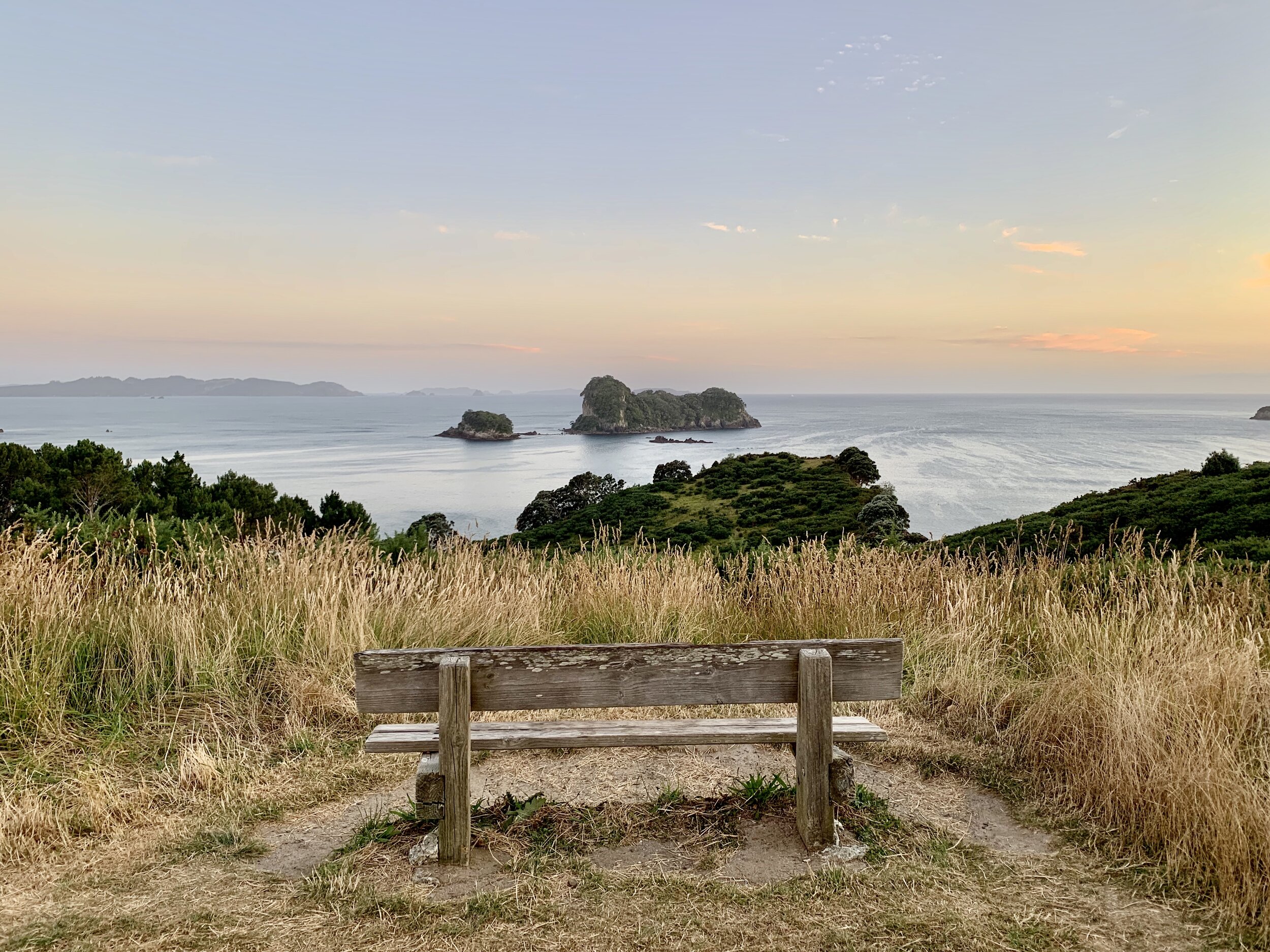
Bench with a view near Cathedral Cove

Bench with a view near Cathedral Cove

Cathedral Cove

Cathedral Cove

Tree groves at Cathedral Cove

Tree groves at Cathedral Cove

The following morning, I woke up before sunrise to walk to Cathedral Cove before the crowds. It was well worth it, as there were just a few others there, and the lighting was spectacular for photography. Incredibly crowded and hence skippable, however, was Hot Water Beach. There are a number of other spots where you can enjoy the thermal heat without the crowds (more on that later). Breakfast at Flatwhite in Waihi features a great view over the ocean and delicious food, and we were lucky enough to be in town for the weekly farmer’s market, where we purchased some eggs and avocados for the coming days. 

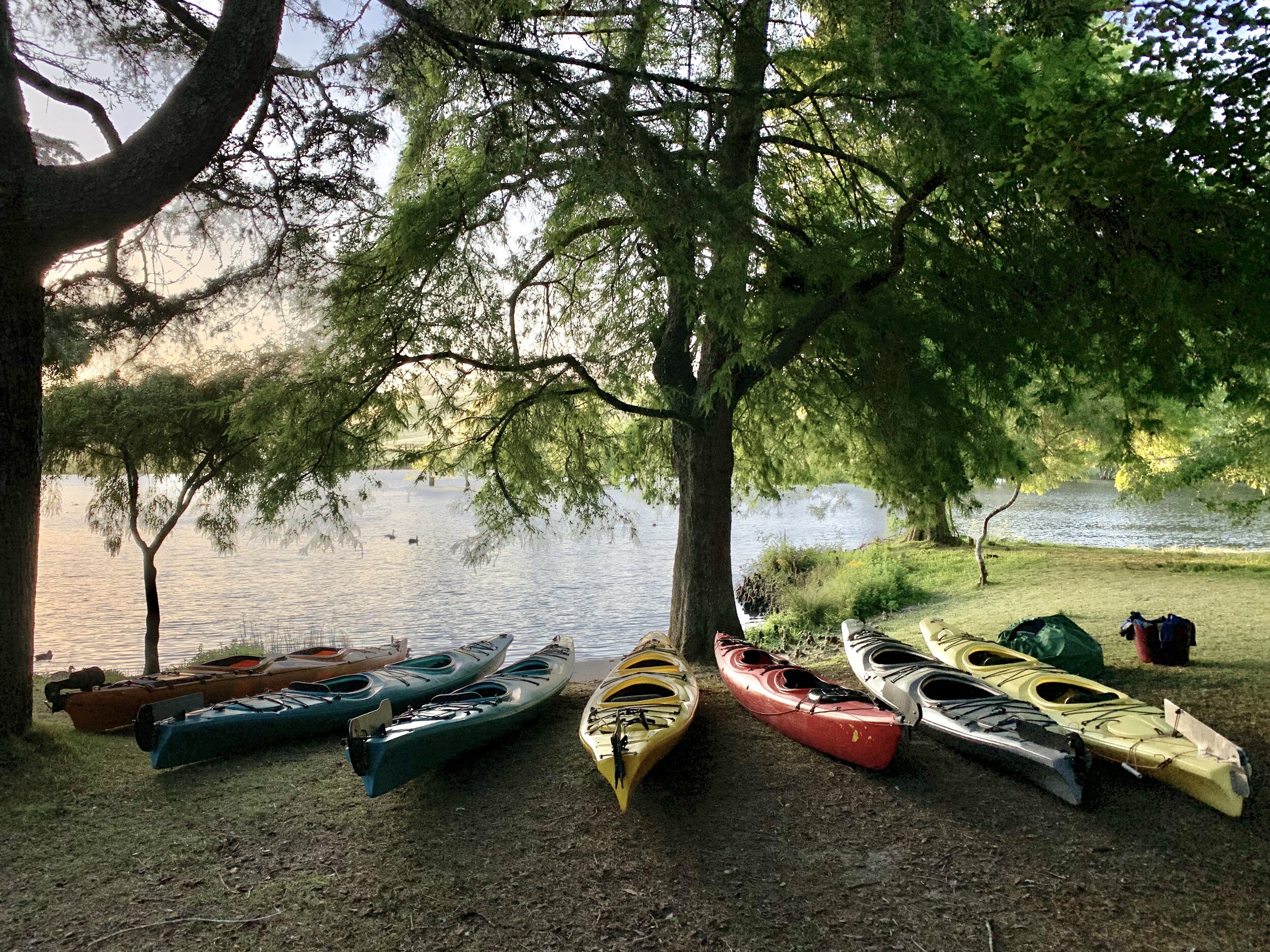
Also well worth a stop is the Leveret Estate winery, which features award-winning and reasonably priced wines as well as very kind and patient salespeople. From there, we checked into our Airbnb in Tauranga (with a hot tub!), where we were welcomed by the very kind Pete and Karen and nice views over the surrounding area. We headed to Waimarino Adventure Park for an evening kayaking trip to McLaren Falls Park, complete with more glowworms. We set out in small groups of kayakers as the last rays of the day illuminated the lake and its numerous black swans and headed upstream to a few channels where glowworms illuminate the surrounding rocks. It was truly a magical evening. 

Kayaking in McLaren Falls park

Kayaking in McLaren Falls park

Sunset at Mt Maunganui beach

Sunset at Mt Maunganui beach

The following morning, I set out early to complete the Tarawera Trail, a 15k one-way hike along Lake Tarawera to Hot Water Beach, which, as the name implies, is a thermally heated beach on the lake where you can dig your own hot water pools or simply swim in heated areas of the lake by the shore. You book a water taxi to take you back from here to where you parked your car. The hike will take you through lakeside bushland and varied tree groves, featuring a number of intermittent climbs. The swim at the end of the hike is a relaxing reward, though be sure to book your water taxi in advance, as it runs only if it’s been booked.  

Tarawera trail

Tarawera trail

Hot Water beach, Lake Tarawera

Hot Water beach, Lake Tarawera

The following morning was New Year’s Eve, and in an effort to show off some dewy skin, we booked a mudbath and sulphur bath at the aptly named Hell’s Gate. A walk through the area takes you through various bubbling pools and beautiful colours from the bacteria that survive in this extreme temperatures before you settle into the mudbath. An attendant will explain the best way to apply the mud, and after 20 minutes, you are whisked off to the sulphur pools (bring an old bathing suit, as you will likely never be able to wash out the smell) to allow your skin to further soften. 

Waimangu Volcanic Valley

Waimangu Volcanic Valley

Afterwards, I hiked through the nearby Waimangu Volcanic Valley, which features numerous spectacularly coloured pools and streams due to the underlying thermal activity in the area. In the evening, we enjoyed the small fireworks show over Lake Taupo and lingered on the beach, parts of which are also thermally heated. It was a fitting end to a spectacular decade.

Kayaking on Lake Taupo

Kayaking on Lake Taupo

Mine Bay Maori rock carvings, Lake Taupo

Mine Bay Maori rock carvings, Lake Taupo

I started off the New Year the following morning with a 5k kayak (each way) from Acacia Bay (hire your own kayak or join a tour) to the Maori rock carvings at Mine Bay. Kayaking will take about 75 minutes each way, so it’s not a bad idea to bring along a friend to make it a bit easier on the arms. The rock carvings are quite large and intricate, and the views of snow-capped Mt Tongariro, Mt Ruapehu and Mt Ngauruhoe in the distance over Lake Taupo make the trip even more spectacular. 

Red Crater, Tongariro Alpine Crossing

Red Crater, Tongariro Alpine Crossing

Emerald Lakes, Tongariro Alpine Crossing

Emerald Lakes, Tongariro Alpine Crossing

Tongariro Alpine Crossing

Tongariro Alpine Crossing

Of course, one of the most popular activities in the area is the 20k Tongariro Alpine Crossing hike. Last time I visited New Zealand, strong winds prevented me from doing the hike, but this time the weather was on my side. I booked a one-way shuttle from the Ketetahi car park to the start of the trail with Tongariro Expeditions and found myself starting the hike just after 6am as the golden orb of the sun rose into a hazy morning. The landscape varies from light brush and volcanic rock to something best described as lunar to thick forest, and temperatures vary accordingly; I was grateful for my gloves and windproof jacket at the start of the hike, but I’d shed most of my layers about halfway through. The climax, with the aptly named and spectacularly hued Red Crater coming into view, occurs about halfway through the hike. Soon after, the three bright Emerald lakes steal the show, followed by a steep scramble that leads into the seemingly never-ending descent. 

Mountain biking is also on offer in the area, and we checked out some of the trails that form the Craters of the Moon geothermal area as well as past Huka Falls and up the Waikato River. You can rent bikes from FourB, and take a dip in the Warm Water Lake area of Lake Taupo for a soothing reward afterwards. I very much enjoyed the seafood at the Edgewater Restaurant with views overlooking the sunset on the lake in the evening, and the lamb and scallop risotto at Vine Eatery were one of my favourite meals of the trip. 

Sunset, Lake Taupo

Sunset, Lake Taupo

Abseiling into the Lost World cave, Waitomo

Abseiling into the Lost World cave, Waitomo

On our last day in New Zealand, we did the Lost World tour with Waitomo Adventures, during which you abseil about 100 metres down into a wet cave system and something that truly does look like a long-forgotten world. I was happy to have selected the 4-hour rather than the full day tour: half a day gives a nice highlight of the experience and does not require wearing a wetsuit and getting completely wet. There are glowworms here, too, and the cave features beautiful vistas looking back through the natural window at the entrance. Keep in mind that what goes down into a cave must come up, and there’s a ladder with over 100 rungs that you’ll have to climb at the end to get out. 

Afterwards, we enjoyed cups of locally grown tea and some light snacks at the Zealong Tea Estate en route back to Auckland, where we feasted on cloudy bay clams in a coriander sauce along with fresh oysters at Depot, and lingered over creative cocktail creations at John & May’s. We had a great night’s sleep at our Airbnb in Auckland, which featured amazing views of the city, a hot tub, and yes, a trampoline. The following day, the sky had turned an unearthly yellow hue due to the Australian wildfires. It was a stark reminder that despite being endowed with all the beauty in the world, New Zealand is still affected by human (in)action, and what we do directly affects the world around us.

Auckland Airbnb with a view

Auckland Airbnb with a view

Where to eat & drink

Shucker Brothers, Auckland

Auckland Fish Market, Auckland

Giraffe, Auckland

Depot, Auckland

John & May’s, Auckland

Solar Eating House, Waiheke Island

Man O’ War vineyards, Waiheke Island

Poderi Crisci, Waiheke Island

Three Seven Two, Waiheke Island

Casita Miro, Waiheke Island

Tantalus, Waiheke Island

Stonyridge, Waiheke Island

Cable Bay Vineyards, Waiheke Island

Kaiwaka Cheese shop, Kaiwaka, Northland

Mangonui Fish Shop, Mangonui, Northland

The Coromandel Smoking Co, Coromandel, Waikato

Umu Cafe, Coromandel, Waikato

Salt Restaurant, Whitianga, Waikato

Zealong Tea Estate, near Hamilton, Waikato

Edgewater Restaurant, Taupo, Waikato

Vine Eatery, Taupo, Waikato

Flatwhite, Waihi, Bay of Plenty

Leveret Estate winery, Katikati, Bay of Plenty

Find local businesses, view maps and get driving directions in Google Maps.

Map of the approximate route driven (roughly 2,800km in total)

In search of rhythm in Cape Verde

“Where is Cape Verde?,” you might ask, and you would not be alone. Located a few hundred miles off the coast of Senegal, this set of volcanically formed islands is on few travellers’ radars. The country is also relatively hard to reach - direct flights run from either Lisbon or Ponta Delgada in the Azores, though fares are typically priced very reasonably. Geologically similar to the Azores, Cape Verde also has a Portuguese colonial history, achieving independence in 1975. Portuguese is spoken, as is Creole, with occasional English. 

Praia from the air, Cape Verde

Praia from the air, Cape Verde

But this is a very different place than the Azores. You are no longer in Europe, but in Africa. Upon landing at Praia, I encountered a set of taxis waiting in front of the airport, charging a hefty 1,000 escudos ($10) for the 5-7 minute drive into the city. I declined, as I would have a night in Praia at the end of my trip, and opted to wait the four hours before my next internal flight at the airport cafe. 

I was headed to São Vicente, the home of famed singer Cesária Évora, and the musical and cultural capital of the islands. Binter CV Airlines makes the trip, and on approach to São Vicente, a small church dramatically perched on rocky cliffs appears off the left side of the plane as you touch down 50 minutes later. I’d rented a car from Dyrk, and Emerson, the nephew of the owner, met me at the small airport. He was kind enough to stay with me as we sought to locate Georgette Guesthouse, on the fifth floor of a relatively modern apartment building overlooking the man-made but incredibly striking Laginha beach. The guesthouse’s stunning balcony, spacious rooms and hearty breakfast made it the perfect place to stay in Mindelo. 

View of Laginha beach from Georgette’s guesthouse in Mindelo

View of Laginha beach from Georgette’s guesthouse in Mindelo

After settling in, I went for a quick dip in the ocean, eyeing the island of Santo Antão in the distance, where I would head the following day. But first, food. I had a delicious octopus dish at Kalimba beach club, located directly on the beach, with incredibly friendly staff, followed by my first time trying percebes (goose neck barnacles, which are notoriously difficult and dangerous to gather) at Casa Cafe Mindelo. Percebes taste of the sea, with a texture similar to soft clams. Restaurants in Mindelo frequently feature live music from local bands and artists, and music videos of Cape Verdean artists looped for hours in the city’s cafes. The vibe is vibrant and energised in the most laid back way, so that time flows fluidly, and nothing is ever rushed. This is island life, after all.  

The interior road on Santo Antão

The interior road on Santo Antão

The next morning, I took the ferry (along with my rental car) to Santo Antão, perhaps the most beautiful of the three islands I visited on this trip. The ferry arrives in Porto Novo, which is unremarkable except as a place to get supplies at a local mini-market, or for a fish dinner at the Italian-run Ristorante La Lampara. Take the interior road, a great source of pride for Cape Verdeans, which was hand-paved in granite stones several decades ago over the course of several years to reach Ponta do Sol at the other end. The vistas en route are simply otherworldly: fast-moving fog enveloping lush greenery, steep mountain passes, and locals going about their daily lives watching you as you drive by. I found myself gasping aloud in my car at the sheer beauty. There are also aluguers, or local collective minivans, that drive these routes, but I preferred to have my own car to maintain the freedom to stop when I wanted. As I encountered few other cars along the route, frequent stops for breathtaking views and photos were easy. On a couple occasions, locals approached me for a ride to the next village, and I happily obliged. Even as a solo female traveller, I never felt unsafe - ridesharing is simply a part of the culture, and it led to several interesting conversations and encounters. My Portuguese is basic, but I gave a ride to a papaya grower going to market who left me one as a gift, a schoolgirl who spoke fluent French and was curious about what I was doing in her country, and an elderly gentleman who was going to visit family in a neighbouring town. Yes, I did receive my fair share of stares most everywhere I went, but I ascribe that to the novelty of a solo female traveller in these parts.

View of Covo, the interior crater on Santo Antão

View of Covo, the interior crater on Santo Antão

The mountainous interior of Santo Antão

The mountainous interior of Santo Antão

Once you reach Ponta do Sol, I highly recommend walking the road to Fontainhas (you reach it by heading left after the highest church in town; ask any of the locals), or driving if you’ve got a 4x4. The vistas are striking, and Fontainhas is something of its own world. I made the trek a couple of hours before sunset, and the colour palette was quite unlike anything I’d seen before. As with most places in Cape Verde, I encountered fewer than five other tourists en route.

The road to Fontainhas

The road to Fontainhas

I took the easier (and sometimes paved, thanks to a recent collaboration with an Italian construction company) coastal road to return to Porto Novo, spending the night en route at an Airbnb near Paul, in the village of Pombas. In the waning hours of the afternoon, I strolled by Senhor Ildo’s grog (a local sugarcane liquor) distillery to sample some of the local products and learn about how they are made. In the morning, a sausage and egg cachupa (the national dish, typically a slow-cooked stew of various meats and vegetables) took some time but was a tasty base for the day at Casa Maracuja.

A grog distillery near Paul, Santo Antão

A grog distillery near Paul, Santo Antão

Cachupa at Chez Loutcha, Mindelo, São Vicente

Cachupa at Chez Loutcha, Mindelo, São Vicente

Upon my return to Sao Vicente, I decided to check out Salamansa, a small fishing village on the island’s north coast made famous by a Cesária Évora song by the same name. There’s a small creperie right on the beach, and you can hire kitesurfing equipment should you find yourself there in winter months with higher winds. Baia das Gatas was largely skippable, but driving further east, with dramatic views en route, you’ll reach the rockier stretches of Calhau, where the road ends. Further south lies the sprawling sandy expanse of São Pedro, perhaps the nicest beach on the island. Circle back to Mindelo for dinner at Chez Loutcha (be sure to try the cachupa and the canja de galinha, a hearty take on chicken soup) followed by a nightcap at the Clube Nautico.

The road between Salamansa and Calhau, São Vicente, Cape Verde

The road between Salamansa and Calhau, São Vicente, Cape Verde

On my final day, after flying back to Praia, I chose to explore the capital on foot from my base at my Airbnb in Plateau. Plateau is pleasant enough, and you can walk through the local market as well as by the Presidential Palace. But I would not recommend walking on foot into the central part of town from here: this was the first and only time I felt unsafe in the country, as I encountered solo or pairs of males who made unpleasant comments as I passed, and the general state of affairs was very run-down. I made it on foot to the local monument to Pope John Paul II, who visited the country in 1990, and in whose honour there is both a cross and a statue that serves as something of a local gathering place for all. Although I am not personally religious, visiting this site was personally touching given the Pope was Polish, and I felt a common ground that unites people around the world, despite their many differences. Cape Verde is not an easy place to visit, but it is all the more rewarding for that very reason.

Mindelo, Sao Vicente, Cape Verde

Mindelo, Sao Vicente, Cape Verde

Packing list:

  • Hiking clothes & shoes

  • Rain jacket

  • Mosquito repellent

  • Bathing suit

  • Sunscreen

Where to stay:

Georgette Guesthouse, Mindelo, Sao Vicente

Paul Airbnb, Santo Antao

Praia Airbnb, Santiago

Where to eat and drink:

Kalimba beach club, Mindelo, Sao Vicente

Casa Cafe Mindelo, Mindelo, Sao Vicente

Chez Loutcha, Mindelo, Sao Vicente

Bar Creperie Chez Zoe, Salamansa, Sao Vicente

Ristorante La Lampara, Porto Novo, Santo Antao

Casa Maracuja, Paul, Santo Antao

Nice Kriola, Praia, Santiago

The Azores: lush, dramatic and unspoilt

With Delta offering nonstop flights (May-September only) from JFK to Ponta Delgada, now is the time to travel to the Azores, a set of nine volcanic islands in the middle of the Atlantic, some 1,000 miles west of mainland Portugal. Featuring a temperate climate, the isles are rarely particularly hot or cold, and they receive a fair amount of rain, typically in shorter, passing bursts, mostly in the mountainous interiors. Each island was formed at a different point in history, leading to dramatically different landscapes. Pico, the youngest island, is nearly all black, with bright green spots of grapevines pushing through the volcanic soil. São Miguel, the largest island, was formed over the course of millions of years, and features impossibly blue and green crater lakes and lush greenery. 

The view from Miradouro da Grota do Inferno

The view from Miradouro da Grota do Inferno

We spent three days on São Miguel (four is probably the right amount of time), renting a car (a must to get to see the island) and frequently stopping en route. One of the highlights of any visits is the short walk up to Miradouro da Grota do Inferno, which offers a fantastic vantage point over the village of Sete Cidades and the surrounding blue and green crater lakes. Local legend has it that a princess fell in love with a shepherd boy, and the King forbade their marriage. They met one last time to embrace and cry, and as the princess’s eyes were green and the boy’s eyes were blue, the two lakes formed in those colours.

Mosteiros beach

Mosteiros beach

Sizzling limpets (lapas) at Restaurante Gazcidla, Mosteiros

Sizzling limpets (lapas) at Restaurante Gazcidla, Mosteiros

From there, we checked out the natural thermal pools by the ocean’s edge at Ponta da Ferraria. Wear close-toed shoes to hike across the sharp lava fields to the small natural pools that combine the cool ocean with the natural heat from the sulfurous hot springs. Afterwards, enjoy a lunch or dinner of the day’s catch of fresh fish and sizzling limpets (“lapas”) covered in garlic butter and lemon at Restaurante Gazcidla in nearby Mosteiros. The black sand beach here makes the ocean more accessible for a quick swim in the summertime. 

The northern coast has some of the nicest beaches in São Miguel. Perhaps my favourite is the surfer haven of Praia do Areal de Santa Bárbara, where you will find a surf center and various options for rentals and lessons, as well as the oceanside Tuká Tulá bar and restaurant (reservations recommended for dinner), featuring some of the best limpets of the trip as well as cocktails with local gin and rum. The beach itself is a long stretch of black sand with multiple layers of breaking waves, perfect for swimming, surfing or bodyboarding. Afterwards, enjoy a steak dinner (the local meat is known for its rich flavour) at the Restaurante da Associação Agrícola de São Miguel, or stop for fresh fish and shellfish at Alabote Restaurante in coastally scenic Ribeira Grande. Nearby, you can also sample some of the local liqueurs (passionfruit is a particular favourite) at Ezequiel Moreira Silva & Filhos or Mulher de Capote in Ribeira Grande.

Praia do Areal de Santa Bárbara

Praia do Areal de Santa Bárbara

Municipal pool at Ribeira Grande

Municipal pool at Ribeira Grande

Cozido das furnas

Cozido das furnas

Perhaps the most interesting place to visit on São Miguel is Furnas, an area of high thermal activity, with several natural hot spring pools as well as sulfurous, steamy fissures. One of the typical dishes of the Azores, cozido das furnas, is made here. The dish is a meat and vegetable stew that is placed a few feet underground and cooked by the natural heat in the area. One of the best places to try it (and to stay the night) is the Terra Nostra Garden hotel, which offers it a la carte or as part of a 3-course menu at its beautiful restaurant overlooking the hotel gardens. By dining at the restaurant, you’ll also receive passes for free entrance to the hotel’s park and hot springs (normally a cost of 8 EUR/person), which are a great place to spend the afternoon. 

One of the Terra Nostra thermal pools

One of the Terra Nostra thermal pools

Afterwards, don’t miss the view from Miradouro do Pico do Ferro, a vantage point with a view of the Furnas lake and the place where the restaurants dig in their cozido pots (to go there directly, arrive by 12pm, and be prepared to pay a few euros a person to gain access to the grounds). 

Salto do Cabrito

Salto do Cabrito

Hiking on São Miguel

Hiking on São Miguel

To cool off, we went for a swim at the Salto do Cabrito, an impossibly scenic waterfall that has carved its path through the surrounding rock. Don’t be afraid to drive all the way down the road, which can be a bit steep, to shorten your path to the falls, and bring water shoes, as getting into the falls is rocky and slippery. Not swimmable, but also beautiful, are the waterfalls at the Parque Natural dos Caldeirões, from where you can do numerous hikes as well as abseiling and canyoning. Follow it with a free introduction and sampling of the tea at the Porto Formoso tea factory along the north coast, and stop off at the Miradouro de Santa Iria for sweeping views of the northern coastline.

Miradouro de Santa Iria

Miradouro de Santa Iria

Pineapples growing on the Arruda plantation

Pineapples growing on the Arruda plantation

Ponta Delgada

Ponta Delgada

Mercado da Graça, Ponta Delgada

Mercado da Graça, Ponta Delgada

Ponta Delgada, the Azores’ largest town, has a relatively walkable center, but is otherwise not particularly pedestrian friendly, and it has a severe parking shortage. We dropped by O rei dos queijos to try (and buy) some Azorean cheeses and bolos, the local bread, and checked out the fruits and vegetables for sale at the Mercado da Graça next door. On the outskirts of town, Ananases A Arruda is a pineapple plantation (an important local product) where you can view the different stages of pineapple farming and sample them in various formats at the onsite cafe. 

We also visited two other islands, Faial and Pico. The best way to reach either is to fly via Azores Airlines (50 minutes), taking the ferry to get between Faial and Pico (30 minutes). Faial’s highlight is probably the Praia Do Almoxarife, from which on a clear morning you can clearly see Pico mountain, Portugal’s highest peak, on the neighbouring island of the same name. Also worth a visit is the Caldeira do Cabeço Gordo, from which you can do a number of different hikes across the island, as well as the Centro de Interpretação do Vulcão dos Capelinhos, from where you can see the destruction caused by the 1957-58 eruption of the Capelinhos volcano and the stunning surrounding landscape. For lunch, we had a delicious octopus salad and Portuguese sparkling wine at Praya, overlooking the Praia do Almoxarife. For dinner, I highly recommend Restaurante Canto da Doca in Horta, where you receive a hot slab of volcanic stone together with a selection of raw seafoods and meats, and you proceed to cook your own dinner to your liking.

A magical viewpoint on Faial

A magical viewpoint on Faial

Praia do Almoxarife, Faial, with Pico obscured by clouds in the background

Praia do Almoxarife, Faial, with Pico obscured by clouds in the background

Cooking our own seafood and meats on a volcanic stone at Restaurante Canto da Doca, Horta, Faial

Cooking our own seafood and meats on a volcanic stone at Restaurante Canto da Doca, Horta, Faial

But Pico is the real stunner here, dark and dramatic, where more acidic, typically white wine is made from the grapevines growing in the volcanic soil beneath the looming peak of Pico (tastings are available at the Cooperativa in Madalena). The mountain is hikeable, though ideally requires starting in the middle of the night in order to reach the summit by sunrise. Numerous agencies and guides on the island offer the trip, and you get a t-shirt to commemorate the accomplishment. Also well worth a visit is the Gruta das Torres (reservations recommended), where over the course of an hour, a guide took us through a few hundred metres of Europe’s longest lava tube, a fascinating experience. Afterwards, we enjoyed lunch with a view at the modern Cella Bar just north of Madalena. Don’t miss the octopus salad, and the pork ribs were delicious. It can get windy, so bring a jacket. It was so good, we found ourselves back for dinner, during which we discussed returning again next year. Go before the Azores get more of the attention they deserve.

Volcanic vineyards on Pico

Volcanic vineyards on Pico

Exiting the Gruta das Torres lava tube on Pico

Exiting the Gruta das Torres lava tube on Pico

A selection of local cheeses al fresco at Cella Bar on Pico

A selection of local cheeses al fresco at Cella Bar on Pico

Packing list:

  • Rain jacket

  • Mosquito repellent

  • Bathing suit (bring an old one that you don’t mind getting discoloured from the sulfur in the hot springs)

  • Hiking shoes

  • Water shoes

Where to stay:

Praia de Santos Exclusive Guesthouse, Ponta Delgada, São Miguel

Hotel Verde Mar & Spa, Riberia Grande, São Miguel

Terra Nostra Garden hotel, Furnas, São Miguel

Hotel do Canal, Horta, Faial

Pocinho Bay, Pico

Where to eat:

Tuká Tulá bar and restaurant, Ribeira Grande, São Miguel

Restaurante da Associação Agrícola de São Miguel, Ribeira Grande, São Miguel

Alabote, Ribeira Grande, São Miguel

Restaurante Gazcidla, Mosteiros, São Miguel

Terra Nostra Garden hotel, Furnas, São Miguel

Praya, Faial

Restaurante Canto da Doca, Faial

Cella Bar, Pico